Louisiana

Terra Firma et Novum Regnum Granatense et Popayan
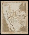
Map of Mexico, or New Spain, Louisiana, and part of California
Gilcrease Museum

Scope and Content Notes
From Map Card:
Herman Moll, (d.1732), Geographer
J. Nutt, London, 1717
Scale: 1:20,000,000
Atlas plate in Atlas Geographus... by Herman Moll, 5 vol. 1711-1717, 100 maps.
See Phillips Atlases, Vol. 1, p. 312 (Entry #557, vol.5 p.[7962]).
Hargrett Collection, p.339
Archival Location
- Collection: Gilcrease Museum Map Collection


