Gilcrease Museum is temporarily closed for construction.

Get the Full Story
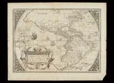
Americae sive Novi Orbis, Nova Descriptio
Abraham Ortelius
America Septentrionalis
Unidentified

Chart of the Caribbean area between Florida and Columbia

Scope and Content Notes

From Map Card:

Caribbean Area

Spanish Cartogtapher, 18th Century

Scale: 1:3,500,000

Probably drawn by the Spanish Royal School of Navigation in Cadiz, Spain, ca.1740.

Portolan, chart drwan on vellum with black ink; has grid markings on north, west, & south. Margins hand colored red, green, black in 12 parts, Spanish plave names.

Provenance: Lord Bute Collection. Purchase No.(3)

Archival Location

You may be interested in...

Title(s): 
Chart of the Caribbean area between Florida and Columbia
Creator(s): 
Spanish Royal School of Navigation (Author)
Date: 
circa 1740
Materials/Techniques: 
vellum
Dimensions: 
Overall: Length: 28 Inches, Width: 36 Inches, Inside neatline: Length: 27 1/4 Inches, Width: 34 1/2 Inches
Classification: 
Object Type: 
Accession No: 
3976.592
Previous Number(s): 
Map 31; 79759; Map 31
Department: 
Not On View

Our Online Collections site is a work in progress. If you have information about this item that may be of assistance, please contact us.