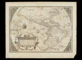
Americae sive Novi Orbis, Nova Descriptio

An Accurate Map of Louisiana and the Territory in Dispute between the English and French
Chart of the Caribbean area between Florida and Columbia
Gilcrease Museum

Scope and Content Notes
From Map Card:
Caribbean Area
Spanish Cartogtapher, 18th Century
Scale: 1:3,500,000
Probably drawn by the Spanish Royal School of Navigation in Cadiz, Spain, ca.1740.
Portolan, chart drwan on vellum with black ink; has grid markings on north, west, & south. Margins hand colored red, green, black in 12 parts, Spanish plave names.
Provenance: Lord Bute Collection. Purchase No.(3)
Archival Location
- Collection: Gilcrease Museum Map Collection


