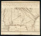
A New Map of Georgia with Part of Carolina, Florida, and Louisiana

General map of North Carolina, South Carolina, and Georgia
Map of North America with the settlements of Virginia and the course of Ohio
Gilcrease Museum

Scope and Content Notes
From Map Card:
North America
Jean d'Anville (1697-1782)
A map of North America from the French of Mr. D'Anville. Improved with the Back Settlements of Virginia and Course of Ohio.
London: Thomas Jefferys, Publisher, 1755
Scale: 1:6,000,000
Shows British Colonies & boundaries, towns, forts, Indian Tribes, streams
Hargrett Catalog, p.34
Archival Location
- Collection: Gilcrease Museum Map Collection


