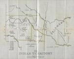
Indian Territory

Progress Map of the U. S. Geographical Surveys West of the 100th Meridian
Indian Territory with Part of the Adjoining State of Kansas
Gilcrease Museum

Scope and Content Notes
From Map Card:
Engineer Bureau, War Dept.
Scale: 1:1,500,000.
Map annotated and colred.
Not in Phillips Maps
Hargrett Catalog, p.344.
Archival Location
- Collection: Gilcrease Museum Map Collection


