Map of Indian Territory

A Map of the Indian Territory, Northern Texas, and New Mexico Showing the Great Western Prairies
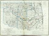
Map of Indian Territory and Oklahoma
Gilcrease Museum

Scope and Content Notes
This map of Indian Territory, present day Oklahoma, was authorized by Congress.
Archival Location
- Collection: Gilcrease Museum Map Collection


