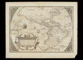
Americae sive Novi Orbis, Nova Descriptio

An Accurate Map of Louisiana and the Territory in Dispute between the English and French
Louisiana
Gilcrease Museum

Scope and Content Notes
From Map Card:
Samuel Lewis, Cartographer
Henry Schenk Tanner, Engraver
Philadelphia: J. Conrad & Co. 1804
1:15,000,000
Atlas plate from Arrowsmith & Lewis' New & Elegant General Atlas... 63 maps, 1804
Shows drainage patterns, place names, some Indian Tribes
Phillips Atlases VI p.421 (entry #702, #55)
Archival Location
- Collection: Gilcrease Museum Map Collection


