
Map of Indian Territory and Oklahoma
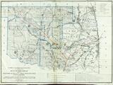
Map of Indian Territory
Map of Arkansas and Indian Territory
Gilcrease Museum

Scope and Content Notes
From Map Card:
Colton, Joseph Hutchin (1800-1893)
Arkansas, Oklahoma (Indian Territory)
New York: J.H. Colton, Publisher [1863]
1"=48mi.
May be one of the 10 maps from R.S. Fisher's A Chronological History of the Civil War in America 160p. 1863
Phillips Atlases v-1 p.747 (Entry #1350)
Archival Location
- Collection: Gilcrease Museum Map Collection

![Indian Territory [Oklahoma] with Part of the Adjoining State of Kansas](https://gm-piction-live.s3.amazonaws.com/styles/see_more/s3/assets/3926.660a-b_o6.jpg?itok=x7H-uL8B)
