
Map of North America with the settlements of Virginia and the course of Ohio
Louisiana
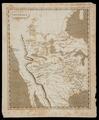
Map of the United States, Northern Mexico, and southern British America
Gilcrease Museum

Scope and Content Notes
From Map Card:
U.S./Canada/Mexico
Boynton, George W., Engraver.
(on exhibit April 1980: Trappers & Traders)
[Philadelphia: Boynton's Stylography, [ca.1850]]
Scale: one inch equals 200 miles.
Not in Phillips, Maps, 1901.
Archival Location
- Collection: Gilcrease Museum Map Collection


